It's not easy being green. Ask any farmer about the green things they grow. They'll tell you their crops are at the mercy of weather, water availability, and the decisions farmers themselves make. With constant choices about when and where to plant, when to water, when to fertilize, and so much more, it's not easy bein' a farmer either. NASA's Earth observation satellites provide information to make life easier for green things and farmers, and thus for all of us who depend on them for food. To harvest specifics about information farmers need, NASA research scientist Christopher Hain (ST11) has been "gettin' down on the farm" with the Agency's Earth Science Director Karen St. Germain, Agriculture Program Lead Brad Doorn, and other experts.

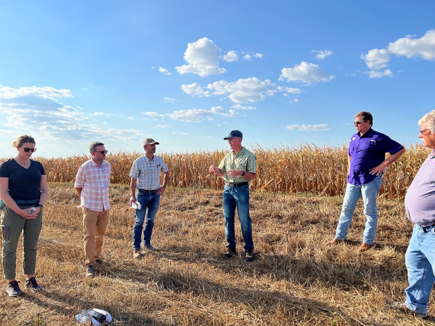
Caption: NASA Gettin' Down on the Farm, (left to right): Alyssa Whitcraft, Deputy Direction and Program Manager for NASA Harvest; Christopher Hain, Research Scientist, Marshall Space Flight Center; Forrest Melton, Senior Research Scientist, NASA Ames Cooperative for Research in Earth Science and Technology (ARC-CREST); Brad Doorn, Program Manager for Water Resources and Agriculture, NASA HQ; Ryan Flickner, Flickner Innovation Farm; Ray Flickner, Flickner Innovation Farm. Located in Moundridge, Kansas, the Flickner Farm has a long history reaching back to the 1870s. (Credit: Aries Keck)
The NASA contingent took a "Space for Ag Roadshow and Listening Tour" through Nebraska and Kansas, visiting farms and, of course, listening to farmers. "They were great hosts, eager to talk to us," says Hain. "A major theme that came through was how important better short-term weather forecasts are for farmers. They need accurate weather information to make the best decisions about caring for their crops."
Hain heads up the NASA SPoRT, or Short-term Prediction Research and Transition, project. As the name implies, SPoRT focuses on improving short-term forecasts. Perfect fit. Weather forecasting is inherently difficult because it's affected by so many interdependent variables, for example the warming of Earth's surface by the sun, the effects of air pressure on winds, and the effects of water changing phases. "To improve weather forecasts, we need to improve how the land is represented in forecast models," explains Hain. "The land surface in the central US is intimately connected to the atmosphere. If you don’t get the land surface right, you won’t get the forecast model to predict things like temperature and precipitation correctly. SPoRT is using NASA satellite data to provide accurate depictions of variables like soil moisture and evapotranspiration, which can affect temperature and precipitation."
Evapotranspiration (ET) is the evaporation of water from the soil plus transpiration, or release of water vapor, from the leaves of vegetation into the atmosphere. It's referred to in the weather world as a "flux." Because soil moisture and related fluxes are important for better weather forecasting, the SPoRT Land Information System has begun producing forecasts of these and other variables out to 14 days. This will help farmers get a better idea of how things like soil moisture could evolve. For example, if they know there's a high chance of significant rainfall they may choose not to irrigate or fertilize their fields.
To enhance accuracy, Hain and his team will use an ensemble-based prediction system, meaning several forecasts will be used to provide a probability of an event such as a flash drought occurring. "The more ensembles the better, in theory," he explains. "We'll run the model 80 times with 80 different atmospheres to generate 80, 14-day forecasts, and then determine the probability that a variable like soil moisture will exceed a given threshold or change by a certain percentage."
Not only is ET important to weather forecasts, it's important to farmers in its own right. ET is a critical measure of how much water needs to be replaced through irrigation or precipitation to ensure appropriately watered, hearty crops with good yields. It's key to water management decision-making and has, in the past, been hard to attain. Hain is on the science team for a tool called OpenET, which makes real-time evapotranspiration data for the western US widely accessible via an online platform. Farmers can use it to map water use even at the field scale. They can go online and view the evapotranspiration numbers to track stress and distribute the water accordingly throughout the season.
Hain and the SPoRT team also co-developed, with the US Department of Agriculture, the Evaporative Stress Index, a satellite-based drought monitoring tool that looks at anomalies in evapotranspiration to assess the direct stress crops are under. Produced over the US at a 4-km scale and globally at a 5-km scale, it captures early signals of "flash drought" brought on by long periods of hot, dry, windy conditions that swiftly deplete soil moisture. To farmers, this is critical information.
When Hain "came in from the fields," he was asked whether he'd rather be a farmer or a research scientist. "I’m a scientist at heart," he answered. "I really appreciate how difficult it is to be a farmer. I think the best way I can help them is to sit at my computer and design solutions to the problems they face out in the fields every day."
Watch an interview with Chris Hain and YouTube sensation Farmer Derek by clicking here: NASA boys and girls getting down on my farm - YouTube.
