Emily Wisinski (UAH), Jordan Bell (ST11), Emma Gilligan (UMB), Andrew Molthan (ST11), and Christopher Schultz (ST11) used daily NASA true color imagery from 2000 – 2020 to create a database of hail damage swath events in the Midwest and Great Plains and to improve understanding of geospatial range and frequency.
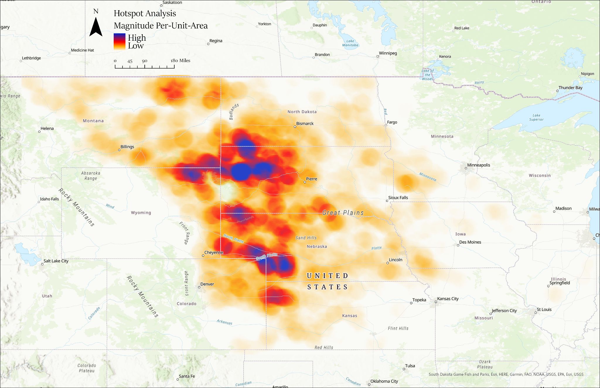
Metadata was on each event and assigned a confidence for identified swaths. For each confirmed event, true color geotiffs from the “Best Date” were downloaded. Geotiffs were imported into desktop GIS software where analysts outlined each swath into a shapefile, and metadata from Google Sheets were also entered into the shapefile. 71,000,000 Acres of land were potentially affected by hail damage swaths and 1,839 events occurred throughout 2000-2020. 2,025 polygons were drawn across 12 states. The results can be seen in image below. Analysis visualizes hotspots for hail damage swaths based on the polygons drawn. Western North Dakota, South Dakota, and Nebraska shows the largest frequency of events occurring.
Researchers plan on continuing applications by developing machine learning techniques to detect swaths and create other databases, improve seasonal and sub-seasonal forecasting of active vs. inactive years, and investigate potential climatological teleconnections.
