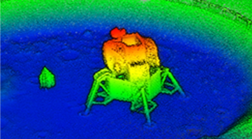
Marshall ST10 (Walt Petersen and Nicole Pelfrey) leaders and ST13 members (David McKenzie, Mitzi Adams, and Michael Zanetti) met with NASA Wallops Flight Facility management (David Pierce, WFF Director, and Range Management Staff led by Scott Schaire) to discuss use of the KNaCK Lidar (Mike Zanetti, ST13, PI). Zanetti explained the KNaCK instrument and its potential for use in high resolution centimeter scale sand dune and marsh mapping and change detection in the coastal environment of the Wallops Island launch facility.
The effort would build on similar dune mapping activities that Zanetti and his team recently conducted at Kennedy Space Center. Also in attendance for the KNaCK meeting were Senior Advisors from the NASA Administrators Staff, Rashahra Lambert and Michelle Barth, who expressed great interest in the KNaCK system and mapping capability, and subsequently requested copies of the presented material. Of specific interest was the ability to map and compute the volume of sand removed in erosion events (e.g., storms) to include monitoring changes in dune, marsh and vegetation ecology and structure.
