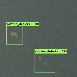
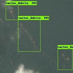
Inter-Agency Implementation and Advanced Concepts (IMPACT) Team members, Ankur Shah and Lilly Thomas, developed deep learning-based marine debris detection using commercial satellite imagery with a 3-meter resolution. Marine debris poses threats to the marine ecosystem and navigation. Detection of such debris can aid efforts in avoiding navigational hazards and cleaning ocean plastic pollution. The IMPACT team curated a dataset of visible marine debris using the ImageLabeler on scenes from the Planetscope satellite. This dataset consists of 1370 bounding boxes of marine debris which were validated using peer-reviewed studies. An object detection deep learning model was trained on our curated dataset and initial results on Planetscope’s optical imagery were obtained. The images below display two examples of the detections from the model. The percentage represents a likelihood accuracy of the detection belonging to the class of marine debris. The team is working on replicating this process on near-infrared imagery and custom spectral indices to enhance marine debris signatures. The goal is to isolate plastic signatures from these detections to aid efforts to clean ocean plastic pollution.

